 by
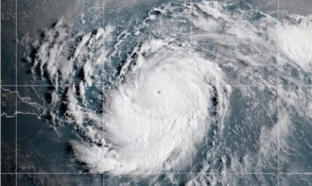
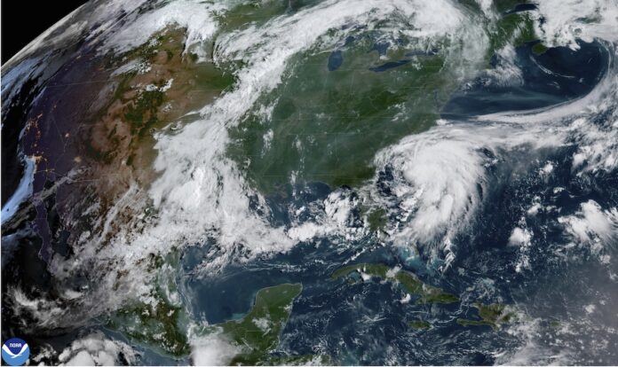
by Parts of the Carolinas were expected to see severe rains on Saturday due to Tropical Storm Chantal, which formed off the southeast coast of the United States. Parts of the two states were under tropical storm warnings, according to the Miami-based National Hurricane Center.
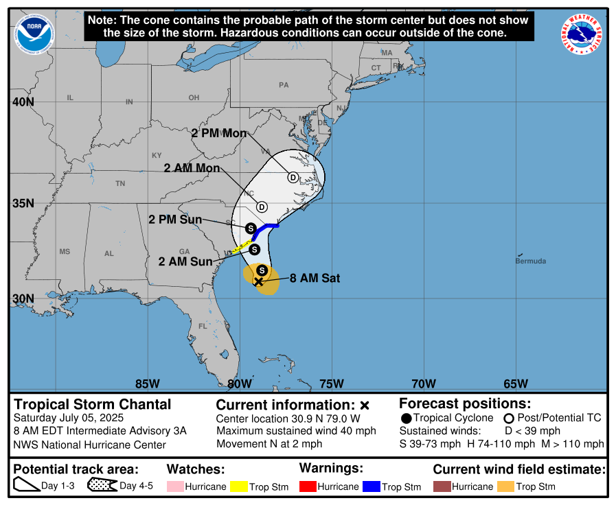
The storm’s core was roughly 105 miles southeast of Charleston, South Carolina, and 185 miles south-southwest of Wilmington, North Carolina, at 2:00 PM EDT on July 5. It was heading north at 3 mph and has recorded maximum sustained winds of 45 mph.
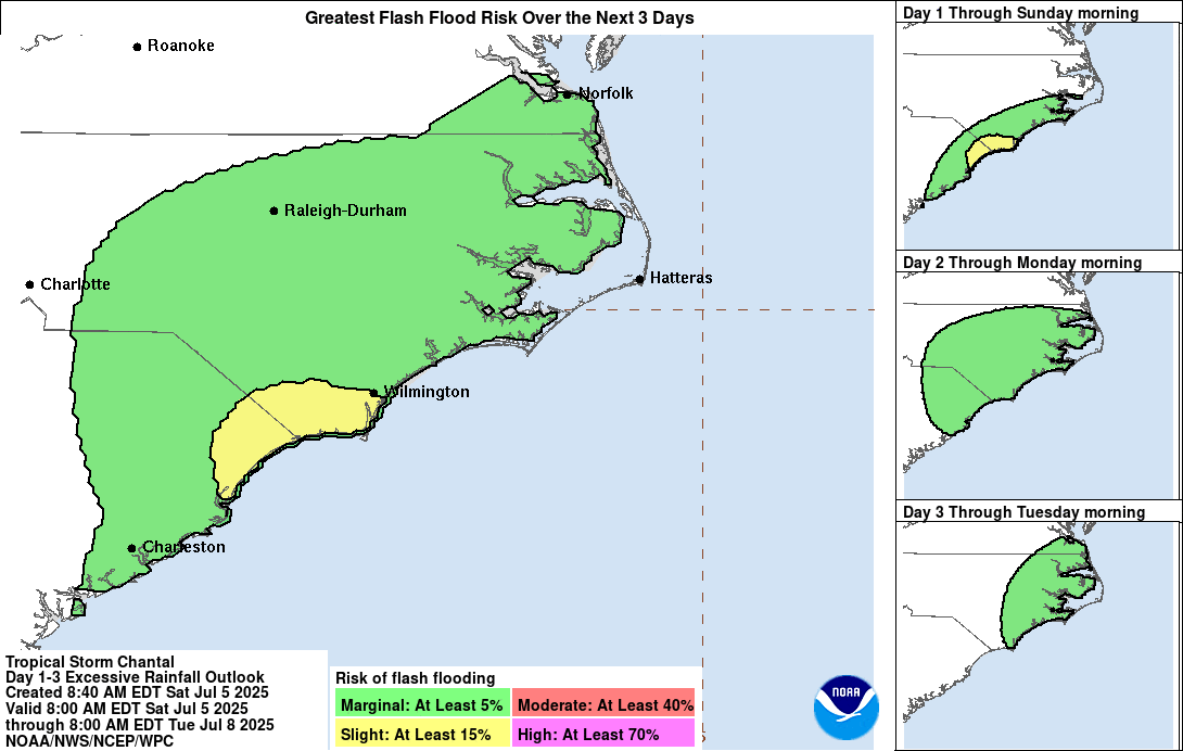
Late Saturday or early Sunday is when the storm’s center is predicted to pass across the South Carolina coast, with some more strengthening predicted before impact. Through Monday, the Carolinas’ coastal plain is expected to see heavy rainfall, with a total of 2 to 4 inches predicted and local totals of up to 6 inches, potentially causing flash flooding.
A Tropical Storm Warning is in force from South Santee to Cape Fear, North Carolina, while a Tropical Storm Watch is still in force for Edisto Beach north to the South Santee River.
Rainfall and strong waves will be the main issues because Chantal is a weak storm. This zone of heavier totals may shift somewhat to the north or south because the heaviest rains will occur just north of where the center of circulation comes onshore.
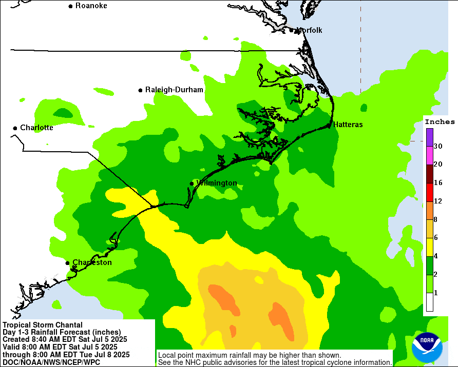
The area is now at a minor (level 2/4) risk of flash flooding, according to NOAA’s Weather Prediction Center.
Along both of the Carolina beaches, severe surf and a high risk of rip currents are forecast for the weekend in addition to the storms.
By Monday morning, Chantal will diminish as it moves inland.
This weekend, if you plan to visit the beach, be ready for rain and choppy waves.